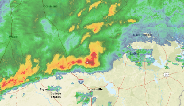
May 9, 2023 - A strong thunderstorm will impact portions of southern De Soto, southeastern Red River, western Natchitoches and Sabine Parishes, Nacogdoches, Shelby, central Angelina, San Augustine and northern Sabine Counties through 4:30pm CDT.
At 3:33pm CDT, Doppler radar was tracking a strong thunderstorm near Zwolle, or 28 miles north of Toledo Bend Dam, moving north at 25 mph.
Hazard: Winds in excess of 40 mph and half inch hail.
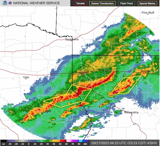
May 5, 2023 - The National Weather Service in Shreveport has issued a Severe Thunderstorm Warning until 1:30am for Panola County in northeastern Texas, Rusk County in northeastern Texas, Nacogdoches County in eastern Texas, Western Shelby County in eastern Texas, Northwestern Angelina County in eastern Texas, Northwestern San Augustine County in eastern Texas, Southeastern Cherokee County in northeastern Texas
At 12:42am CDT, severe thunderstorms were located along a line extending from near Joinerville to Minden to near Trawick to near Forest, moving east at 50 mph.
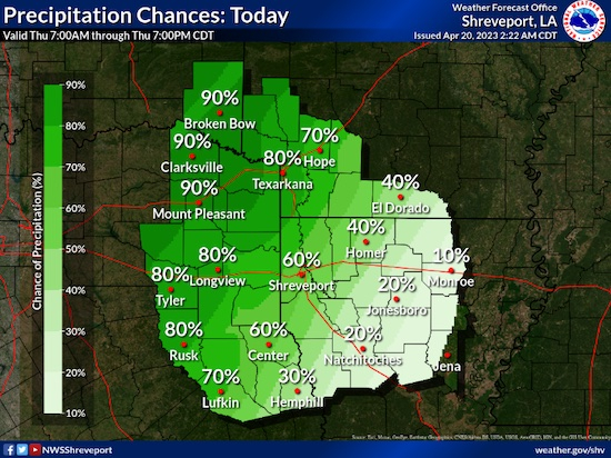
April 20, 2023 - The National Weather Service, Storm Prediction Center, Norman, OK, issued a Severe Thunderstorm Watch outline update for WS 153 at 1:50pm, Thursday, April 20, 2023.
April 2, 2023 - Tornado Watch 111 is in effect until 1am CDT for the following locations - Texas counties included are: Angelina, Camp, Cass, Cherokee, Franklin, Gregg, Harrison, Houston, Marion, Morris, Nacogdoches, Panola, Rusk, Sabine, San Augustine, Shelby, Smith, Titus, Trinity, Upshur, Wood.
March 31, 2023 - The National Weather Service in Shreveport has issued a Severe Thunderstorm Warning for Southwestern De Soto Parish in northwestern Louisiana, Southeastern Panola County in northeastern Texas, Northern Shelby County in eastern Texas.
Until 730pm CDT.
At 641pm CDT, a severe thunderstorm was located near Tenaha, or 11 miles south of Carthage, moving east at 45 mph.