



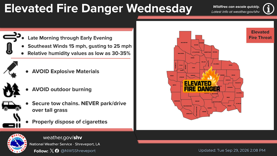
September 29, 2026 - Winds will be increasing out of the south on Wednesday, September 30, gusting to around 25 mph at times. This, combined with low relative humidity and dry fuels will make for favorable conditions for fire starts and spreads.
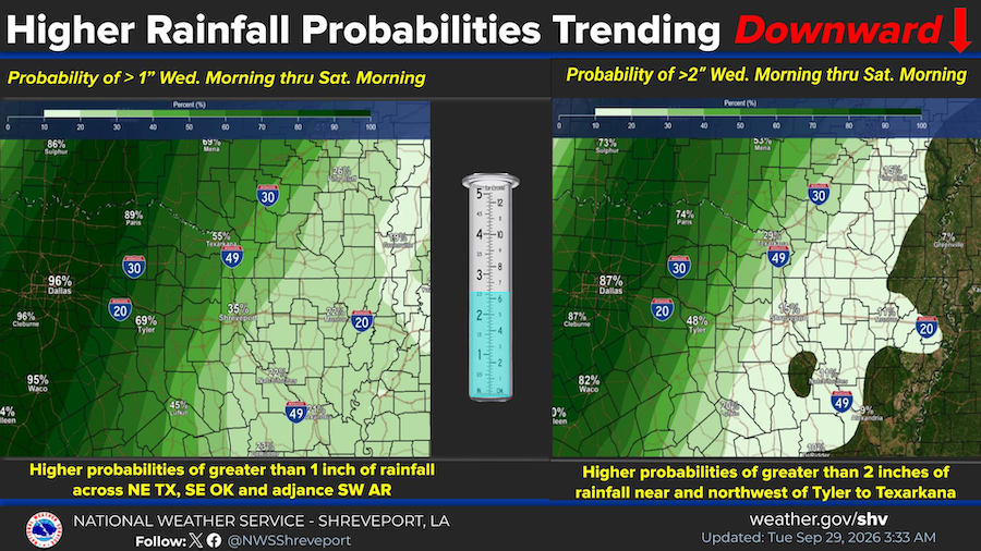
As an upper level trough approaches our region from the west later this week, the probability for rainfall will increase, especially across the west and northwest half of the region but higher rainfall amounts are trending downward.
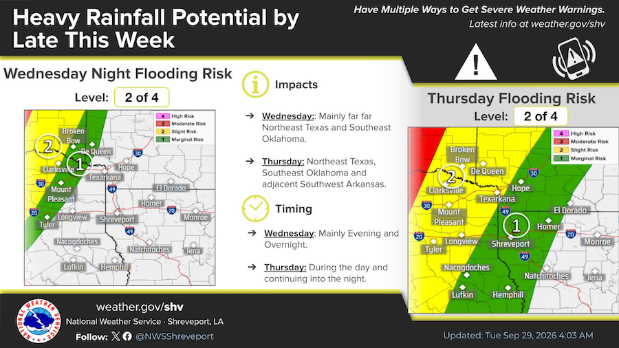
It's looking like at least the western third of the Four State Region could see excessive heavy rainfall by late this week as early as Wednesday Night but especially Thursday into Thursday Night. This could result in some flooding concerns.
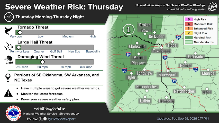
The threat for damaging wind gusts will accompany isolated strong to severe thunderstorms on Thursday, October 1 as a cold front moves into an unstable airmass.
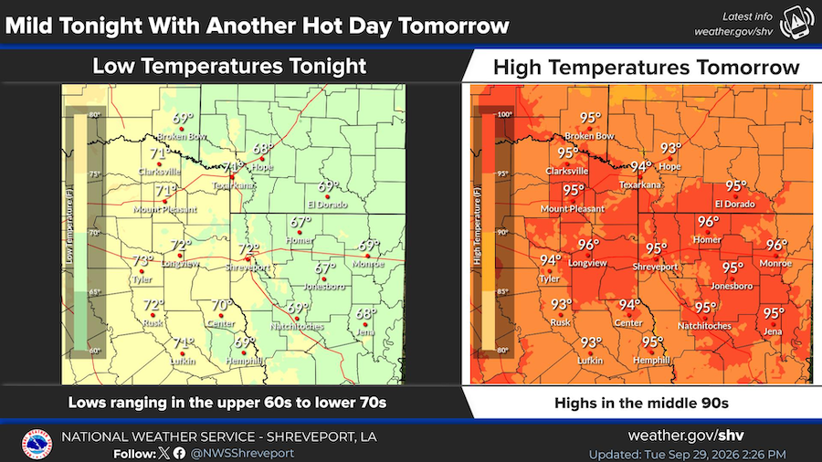
Another mild and seasonably warm night is expected tonight, with highs tomorrow again reaching well into the 90s.