



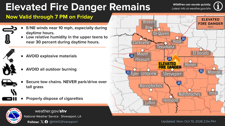
October 19, 2026 - Dry air will continue to remain in place every day this week. This combined with dry fuels and drought conditions will promote an environment prone to wildfire ignitions. Please follow your county or parish burn ban guidance.

Seasonably cool and dry weather will continue for the Four State Region with calm winds under mostly clear skies allowing temperature minimums in the upper 40s/lower 50s. Daytime heating on Tuesday will boost temperature maximums into the lower 80s with light east winds at 5 mph.
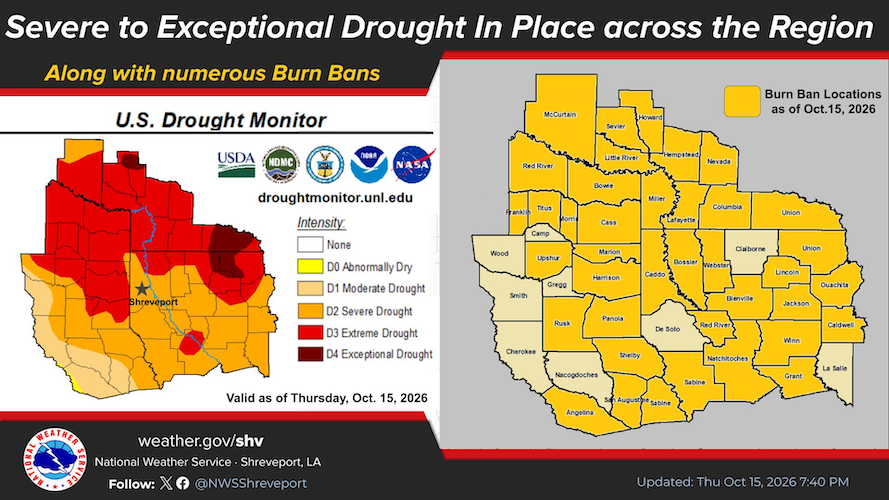
Severe to exceptional drought continues across our region, along with numerous Burn Bans. Please remember to check with your local, county/parish, or state officials before starting any outdoor fires. (As of this article, Shelby County is currently under a burn ban.)
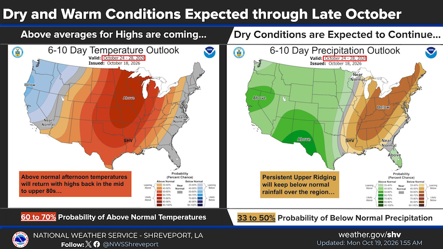
The Climate Prediction Center's 6 to 10 day outlook remains warm with below average rainfall through late October.
Detailed Forecast for Shelby County, TX
- Tonight - Partly cloudy, with a low around 50. Northeast wind around 5 mph becoming calm.
- Tuesday - Sunny, with a high near 78. Calm wind becoming east around 5 mph in the afternoon.
Tuesday Night - Mostly clear, with a low around 51. Calm wind. - Wednesday - Sunny, with a high near 82. Calm wind becoming northeast around 5 mph in the afternoon.
Wednesday Night - Clear, with a low around 52. Calm wind. - Thursday - Sunny, with a high near 84.
Thursday Night - Mostly clear, with a low around 51. - Friday - Sunny, with a high near 83.
Friday Night - Mostly clear, with a low around 53. - Saturday - Sunny, with a high near 82.
Saturday Night - Mostly clear, with a low around 54. - Sunday - Mostly sunny, with a high near 80.
Sunday Night - Partly cloudy, with a low around 53. - Monday - Mostly sunny, with a high near 80.