


 March 11, 2016 (Toledo Bend Reservoir) - Spillway releases from the Toledo Bend Reservoir are being reduced as lake levels lower in the aftermath of the major rain event which dropped 18 inches of water directly over Toledo Bend. Toledo Bend Reservoir, operated by the Sabine River Authority of Texas and the Sabine River Authority, State of Louisiana reached a record level high of 174.36 feet mean sea level (msl) at 6:00 a.m. on March 10, 2016 due to the rainfall event. The current gauge reading at 4:00 p.m. Friday afternoon is 173.69 feet msl.
Releases through the spillway gates, which protect the integrity of the dam, follow the Guide for Spillway Gate Operation specifically designed for operation of the Toledo Bend Reservoir. Currently 9 gates are open to 20 feet and one generator is running 24 hours per day for a total release of 189,764 cubic feet per second (cfs).
Toledo Bend Reservoir is not a flood control reservoir and reaches full pool at 172.0 feet msl. There is no truth to the rumors that the Toledo Bend dam could break due to the water releases. The integrity of the dam is intact and is operating as designed.
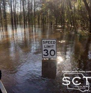
Although rainfall from the major rain event has decreased, impacts from the event will include downstream flooding. The National Weather Service (NWS) is forecasting a record flood event for Southeast Texas and Southwest Louisiana. Their latest forecast shows gauge heights to go over flood stage in Burkeville, Bon Weir, Deweyville and Orange.
The Burkeville gauge reached a peak flood stage of 53.82 feet at 2:30 p.m. Friday afternoon which is over 6 feet above the flood stage recorded in 1989. The gauge at Bon Wier is forecasted to peak at 39.9 feet on Saturday, March 12th which is 2 feet above the flood stage recorded in 1989. NWS forecasts show a slow decrease for both gauges through next week.
The Ruliff (Deweyville) gauge is forecasted to peak at a new record of 34.4 feet Tuesday, March 15th which will be 5.2 feet above the flood level recorded in 1989. The water surface is forecasted to reach moderate flood stage (26 feet) on Saturday afternoon and major flood stage (28 feet) on Sunday morning climbing to the record peak by Tuesday. The Orange gauge is forecasted to rise above the flood stage of 4 feet on Monday, March 14th and climb to a peak of 6.7 feet by Wednesday, March 15th. This forecast is 9 inches above the flood level recorded in 1989. The Sabine River Authority of Texas (SRA-TX) and the Sabine River Authority, State of Louisiana (SRA-LA) want to emphasize the importance of keeping informed and staying safe during this flooding event. Although SRA-TX and SRA-LA are coordinating with local Emergency Management Departments throughout the Lower Sabine River Basin, County and Parish officials handle any evacuation orders. Please contact your local county and parish offices for more information.