



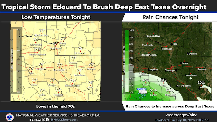
September 1, 2026 - Tropical Storm Edouard to weaken as it moves across southeast Texas this afternoon and tonight. Widespread rainfall and windy conditions are expected across much of Deep East Texas overnight.
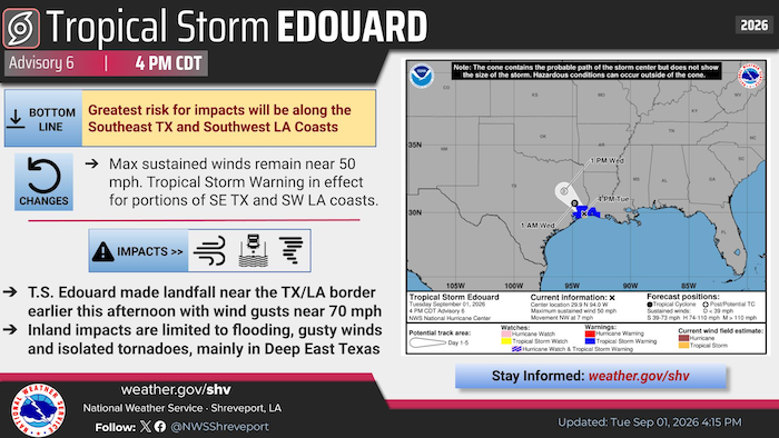
Tropical Storm Edouard made landfall earlier this afternoon near Sabine Pass. Potential impacts in our area will be mainly limited to Deep East Texas, including flooding, gusty winds and isolated tornadoes.
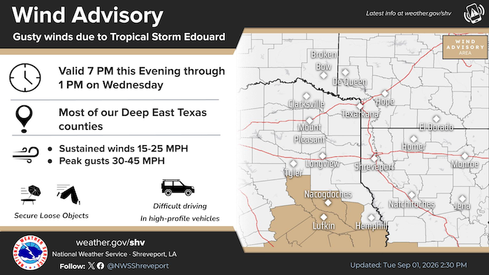
A Wind Advisory is in effect for much of Deep East Texas from this evening through early Wednesday afternoon as Tropical Storm Edouard is expected to move inland over the next 24 hours. Wind gusts between 30-45 mph will be possible in the advisory area.
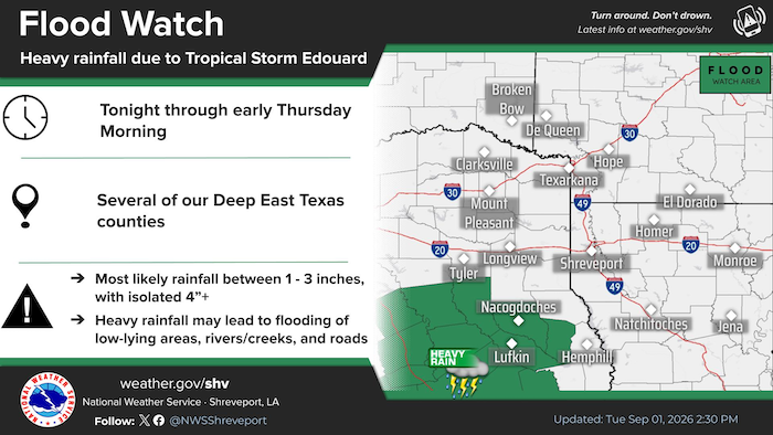
A Flood Watch is in effect for much of Deep East Texas from this evening through early Thursday morning as Tropical Storm Edouard moves farther inland overnight. The most likely rain amounts range between 1-3 inches with isolated higher amounts of 4+ inches in the advisory area.
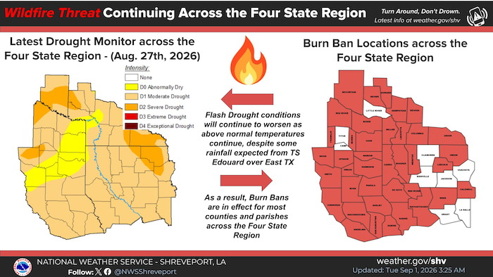
Despite some recent rainfall, flash drought conditions continue across the entire Four State Region. As a result, much of the region is under a Burn Ban at this time. The wildfire threat will continue with no significant rainfall expected through the first week of September.