



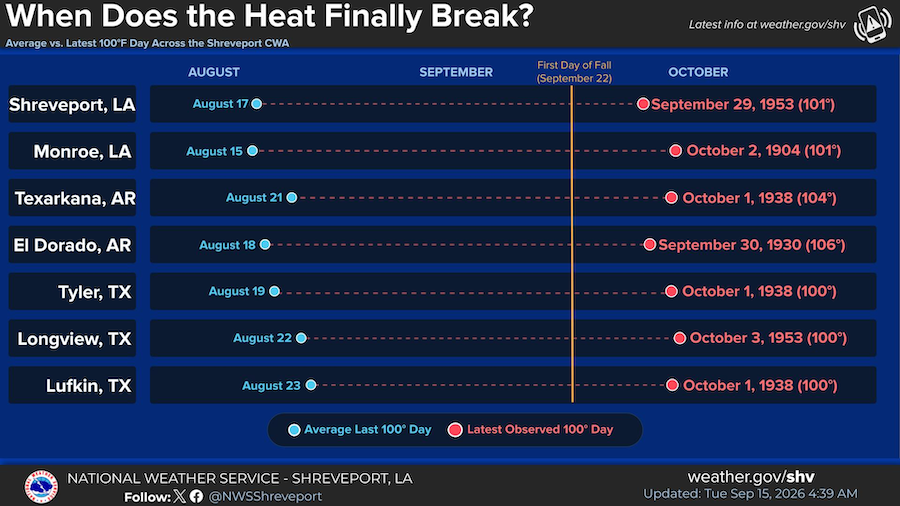
September 15, 2026 - Tired of the heat? Us too... Summer is supposed to be winding down, but the heat doesn’t always get the memo. We’re well past the average last 100°F day across the Shreveport CWA, yet all 7 climate sites have recorded their latest 100°F day after the first day of fall.
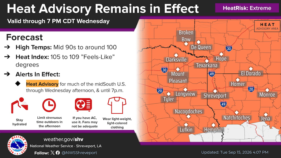
A Heat Advisory remains in effect through 7 PM Wednesday. Heat index values will range from 105° to 109° during the afternoon hours. Please use caution when outdoors and know the signs of heat related illnesses.
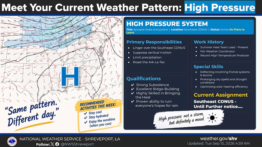
Same pattern, different day! Meet the stubborn High Pressure System currently taking up residence over the Southeast CONUS. Check out its "resume" to see what we're dealing with. Its special skills include prolonging dry spells, deflecting storms, and roasting the Ark-La-Tex. Stay cool and hydrated out there!
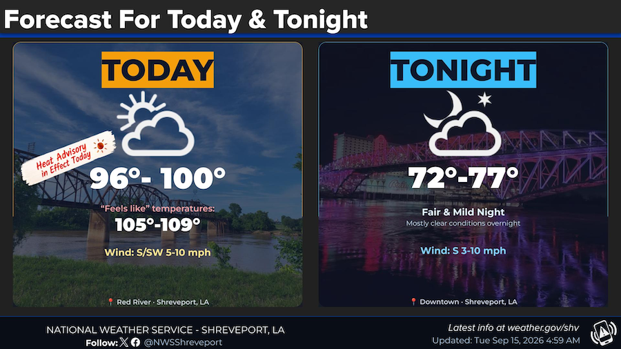
High temperatures today will range from the mid 90s to around 100 degrees under partly cloudy skies. Heat index values will range from the 105° to 109° this afternoon. Overnight lows will be in the lower to mid 70s.