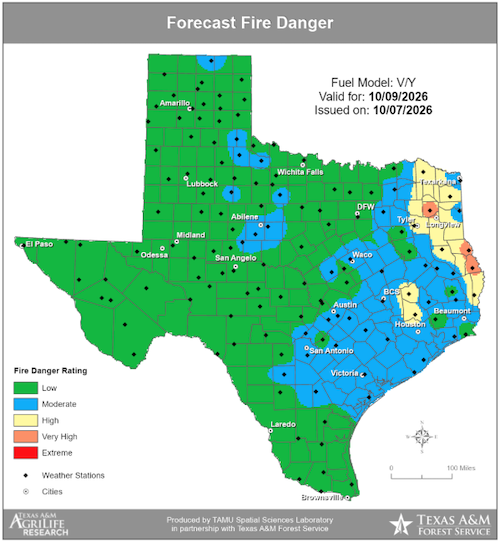



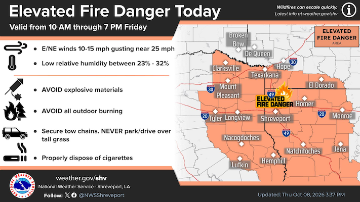
October 8, 2026 - Dry conditions and northeast wind gusts up to 25 mph to make for favorable wildfire conditions on Friday, October 9, 2026. The elevated fire danger issued by the National Weather Service is valid from 10am today through 7pm Friday.
Winds out of the East / Northeast are expected to be 10-15mph with winds gusting near 25mph along with low relative humidity between 23% to 32% increases the fire danger across the area to elevated.
To help present fires:
- Avoid explosive materials
- Avoid all outdoor burning
- Secure tow chains and Never park/drive over tall grass.
- Properly dispose of cigarettes
Although, tropical storm Isaias has been upgraded to Hurricane Isaias, on its current track, no significant impacts are expected for Shelby County.
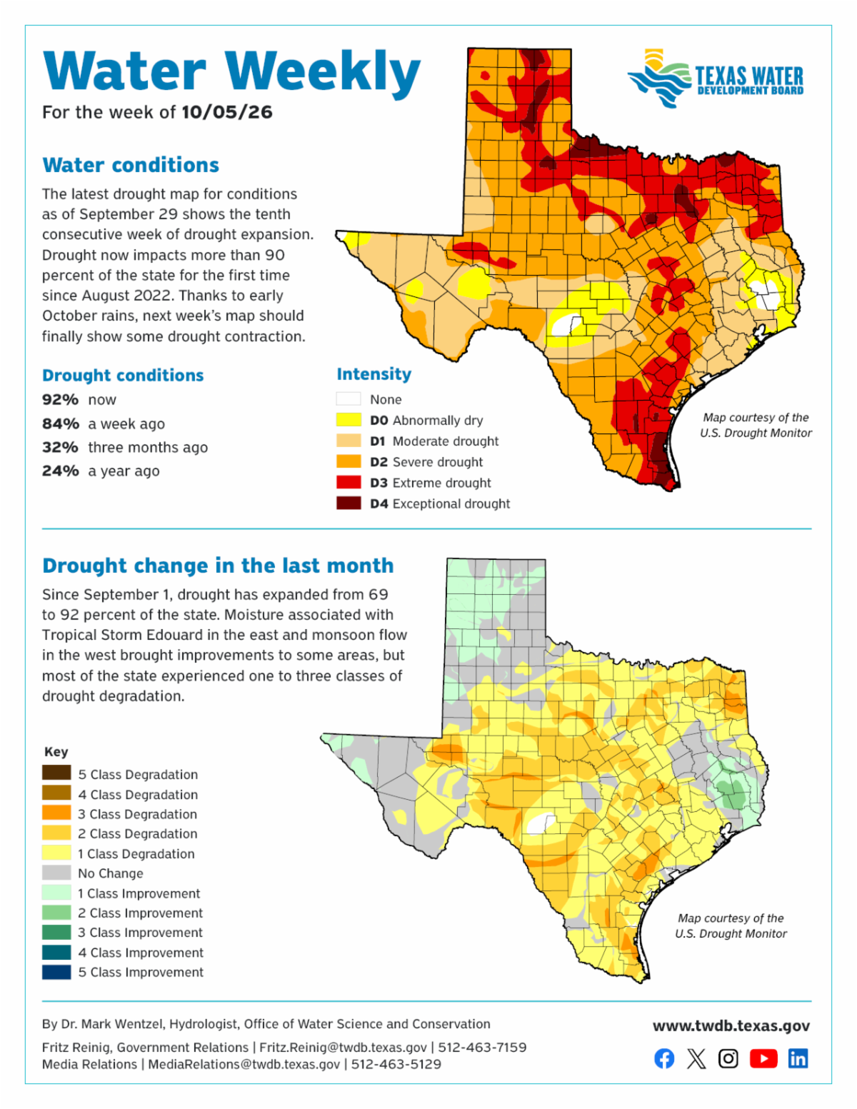
Water Weekly for the week of October 5, 2026
Water Conditions
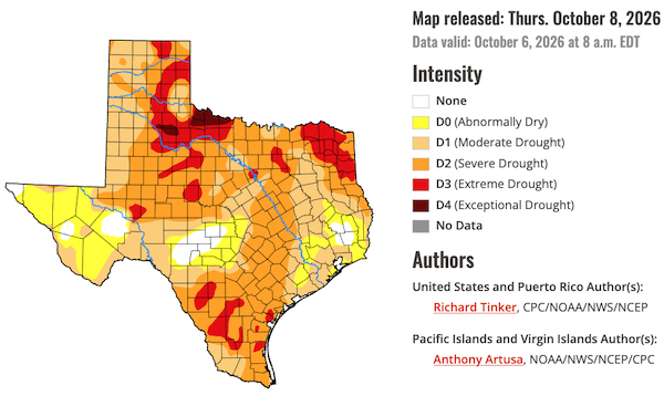
The latest drought map for conditions as of September 29 shows the tenth consecutive week of drought expansion. Drought now impacts more than 90 percent of the state for the first time since August 2022. Thanks to early October rains, next week's map should finally show some drought contraction.
Shelby County drought intensity conditions show Severe Drought.
Click image to enlarge