


April 4, 2019 - National Weather Service Storm Prediction Center, Norman, Oklahoma issued at 5:35pm CDT on Thursday, April 4, 2019 a severe thunderstorm watch 37 which is in effect until 12 midnight CDT for the following locations: (Texas counties) Angelina, Hardin, Jasper, Jefferson, Nacogdoches, Newton, Orange, Sabine, San Augustine, Shelby and Tyler.
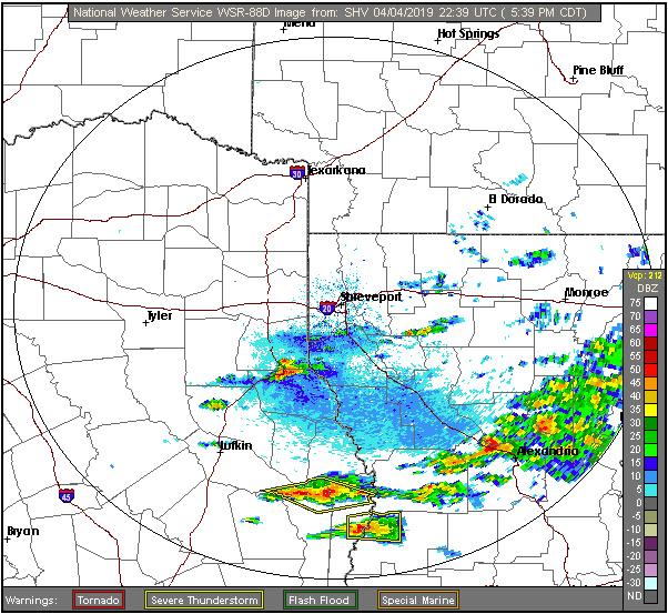
At 5:25pm CDT, a significant weather advisory for west central DeSoto Parish, southeastern Panola and north central Shelby Counties until 6:15pm.
At 5:25pm CDT, Doppler radar was tracking a strong thunderstorm near Tenaha, or 10 miles south of Carthage, moving east at 25 mph.
Half inch hail and winds in excess of 30 mph will be possible with this storm.
Locations impacted include... Logansport, Tenaha, Timpson, Joaquin, Gary City, James, Woods and Paxton.
PRECAUTIONARY/PREPAREDNESS ACTIONS...
Frequent cloud to ground lightning is occurring with this storm. Lightning can strike 10 miles away from a thunderstorm. Seek a safe shelter inside a building or vehicle.
This storm may intensify, so be certain to monitor local radio stations and available television stations for additional information and possible warnings from the National Weather Service.