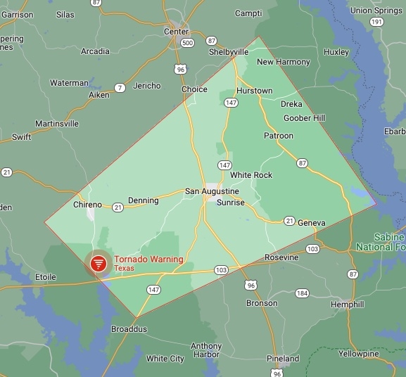
March 14, 2022 - The National Weather Service, Shreveport, LA issued a severe weather statement at 9:33pm Monday, March 14, 2022. A tornado warning remains in effect until 10pm CDT for Southeastern Nacogdoches and West Central San Augustine Counties.
At 932 PM CDT, a severe thunderstorm capable of producing a tornado was located near Etoile, or 20 miles east of Lufkin, moving northeast at 30 mph.
HAZARD... Tornado and golf ball size hail.
SOURCE... Radar indicated rotation.
IMPACT... Flying debris will be dangerous to those caught without shelter. Mobile homes will be damaged or destroyed. Damage to roofs, windows, and vehicles will occur. Tree damage is likely.
This tornadic thunderstorm will remain over mainly rural areas of southeastern Nacogdoches and west central San Augustine Counties, including the following locations... Chireno and Broaddus.
PRECAUTIONARY/PREPAREDNESS ACTIONS...
TAKE COVER NOW! Move to a basement or an interior room on the lowest floor of a sturdy building. Avoid windows. If you are outdoors, in a mobile home, or in a vehicle, move to the closest substantial shelter and protect yourself from flying debris.
Tornadoes are extremely difficult to see and confirm at night. Do not wait to see or hear the tornado. TAKE COVER NOW!