


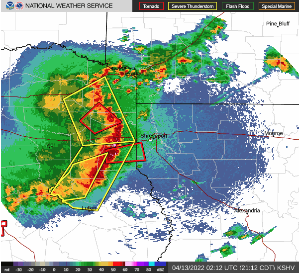
April 12, 2022 - At 9:25pm, Tuesday, April 12, 2022 the National Weather Service in Shreveport issued a Severe Thunderstorm Warning for De Soto Parish in northwestern Louisiana... Northwestern Red River Parish in northwestern Louisiana... Southern Caddo Parish in northwestern Louisiana... Southeastern Bossier Parish in northwestern Louisiana... Northwestern Sabine Parish in northwestern Louisiana... Southeastern Harrison County in northeastern Texas... Eastern Panola County in northeastern Texas... Northeastern Nacogdoches County in eastern Texas... Shelby County in eastern Texas... Northern San Augustine County in eastern Texas… and Northwestern Sabine County in eastern Texas… until 10:15pm.
At 9:25pm, severe thunderstorms were located along a line extending from 6 miles west of Elysian Fields to near Nacogdoches, moving east at 40 mph.
Radar indicates hazardous weather includes 60 mph wind gusts and penny size hail. Expect damage to roofs, siding, and trees.
Locations impacted include... Shreveport, Bossier City, Center, Mansfield, Greenwood, San Augustine, Stonewall, Logansport, Tenaha, Joaquin, Martinsville, Shelbyville, Melrose, Patroon, Bland Lake, Neuville, Woden, Chireno, Huxley and South Mansfield.
PRECAUTIONARY/PREPAREDNESS ACTIONS...
A Tornado Watch remains in effect until 200 AM CDT for northwestern Louisiana...and eastern and northeastern Texas.
For your protection move to an interior room on the lowest floor of a building.
A Tornado Watch remains in effect until 200 AM CDT for northwestern Louisiana...and eastern and northeastern Texas.