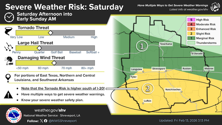
February 14, 2026 - Tornado Watch 5 remains valid until 9pm CST this evening for the following areas in Louisiana this watch includes four parishes in northwest Louisiana: Bossier, Caddo, De Soto, Sabine.
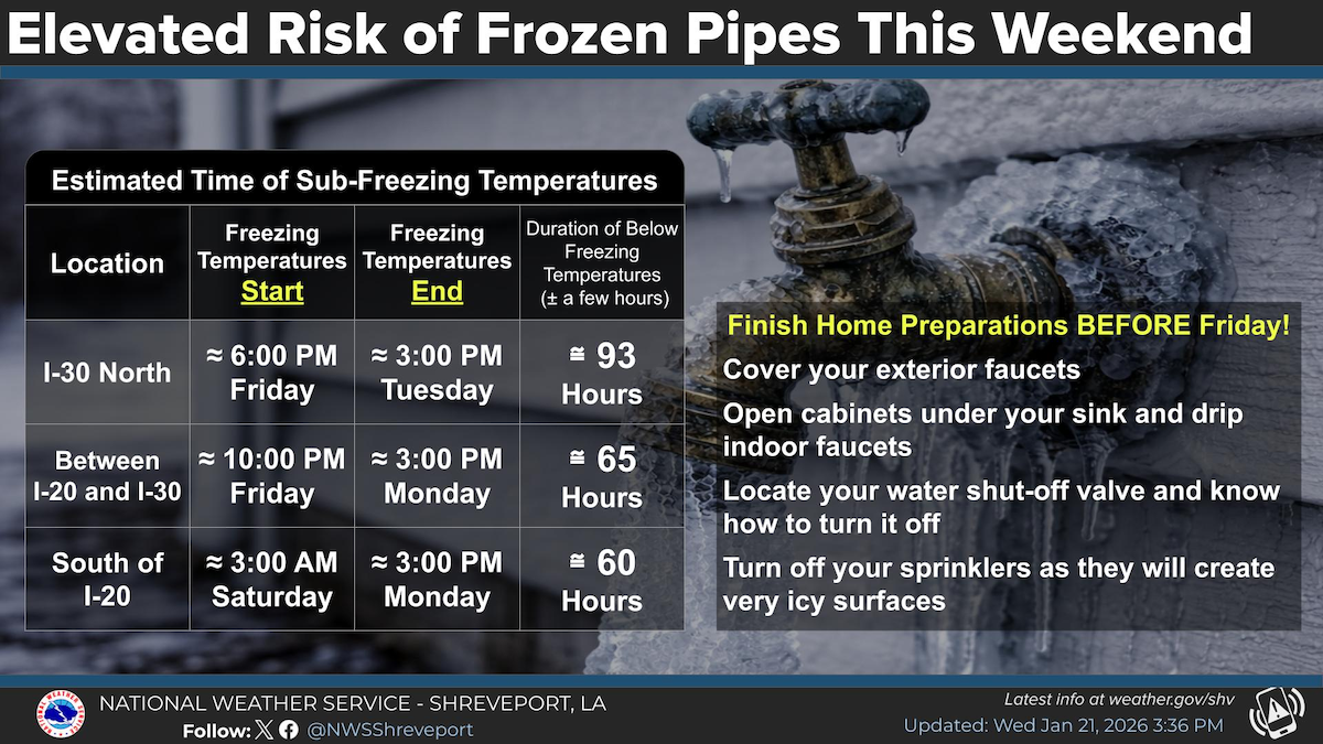
January 22, 2026 - Much of our area will see an extended period of time of sub-freezing temperatures. Right now we are looking at around 60-90 hours of below freezing temperatures across the region.
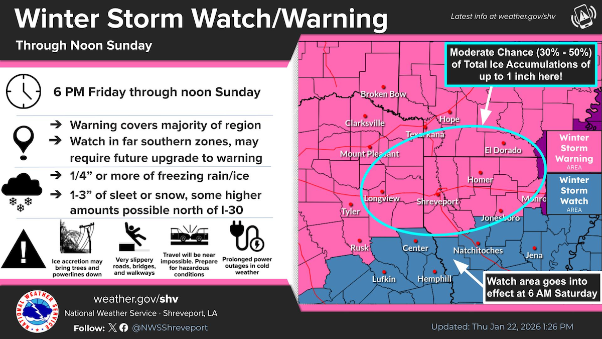
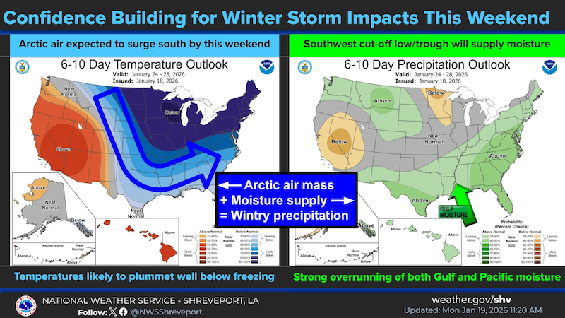
Updated: The entire Four-State region is now under either a Winter Storm Watch or Winter Storm Warning as a significant winter storm is poised to impact the entire region this weekend. A combination of freezing rain, sleet, and snow can be expected with this event.
January 22, 2026 - The National Weather Service, Shreveport, Louisiana issued an Extreme Cold Watch at 11:18am on Tuesday, January 22, 2026 for Shelby County, Texas. Extreme Cold Watch is in effect from Sunday evening through Tuesday morning....
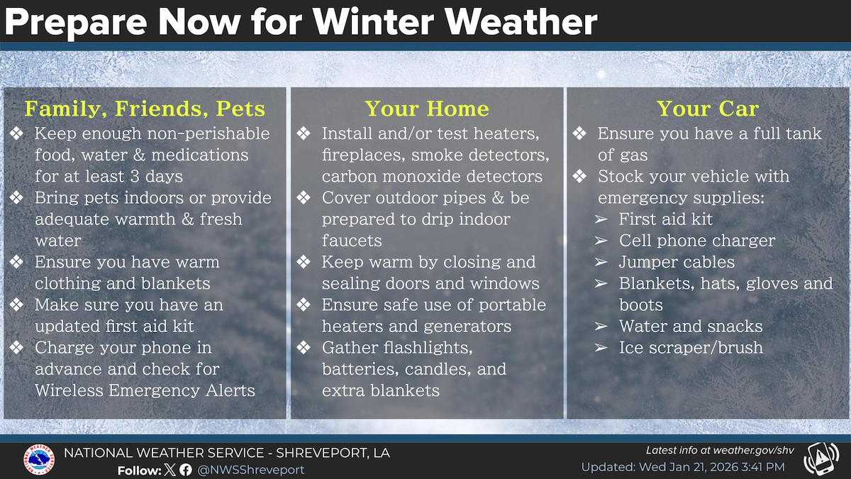
January 21, 2026 - Now is the time to prepare for potential winter weather this upcoming weekend. Make sure you make plans to care for your family, friends and pets, as well as make preparations for your home and car.
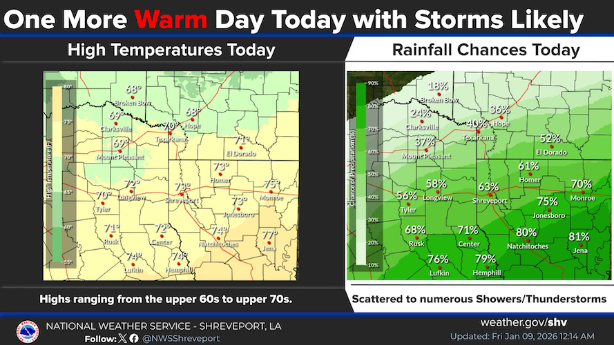
January 9, 2026 - A strong thunderstorm will impact southeastern Nacogdoches, Angelina, southeastern Panola, northwestern Sabine, San Augustine and Shelby counties and southwestern De Soto and northwestern Sabine parishes until 2:45pm CST.
At 2:13pm CST, Doppler radar was tracking a strong thunderstorm near Etoile, or 18 miles east of Lufkin, moving northeast at 25 mph.